1893 Map of Hill City
USGS Topo · Published 1949About this map
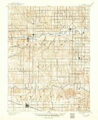
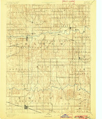
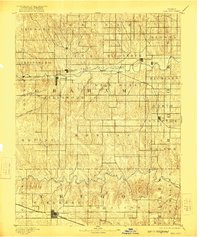
Hill City and Wakeeney anchor this late nineteenth-century portrait of Northwest Kansas, an era when the Union Pacific Railway dictated the rhythm of settlement across the high plains. The map illustrates a landscape defined by its waterways, most notably the South Fork Solomon River and the Saline River, which are fed by numerous family-named drainages like Skunk Creek and Wild Horse Creek. A significant historical detail is the inclusion of Nicodemus, a prominent settlement established by African American pioneers during the post-Civil War migration. This survey by W. J. Peters and H. L. Baldwin Jr. reflects a moment when older sites like Millbrook and Reford remained visible alongside the rising rail towns, documenting the early township organization and the transition from open prairie to structured agricultural life in Graham and Trego Counties.
Find a feature on this map
41 named features on this map. Tap any name to fly to it.
Don’t see what you’re looking for? This feature index may not catch every label — zoom into the map to look around manually.
Map Details
Editions of this 1893 Hill City Map
4 editions found

Historical Maps of WaKeeney Through Time
1 maps found