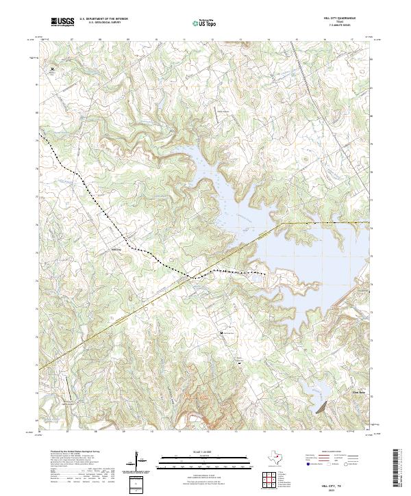
2023 Map of Hill City
USGS Topo · Published 2023About this map
Hill City and Glen Rose anchor the landscape where the Hood Co Somervell Co boundary line crosses the winding course of Comanche Creek. This modern survey reveals a countryside shaped by its hydrology, where several named branches and hollows like Opossum Hollow and Buzzard Hollow feed into the larger creek systems. The rural character is punctuated by essential community markers for genealogists and local historians, including the Mount Pleasant Cem, Post Oak Cem, and Milam Chapel Cem.
Find a feature on this map
78 named features on this map. Tap any name to fly to it.
Don’t see what you’re looking for? This feature index may not catch every label — zoom into the map to look around manually.
Map Details
Editions of this 2023 Hill City Map
This is the sole edition of this map. No revisions or reprints were ever made.
Other maps of this area

1889 · Granbury
USGS Topo · 1:125,000

1923 · Granbury 2-a
USGS Topo · 1:48,000

1923 · Granbury 1-b
USGS Topo · 1:48,000

1924 · Granbury 1-c
USGS Topo · 1:48,000

1928 · Godley
USGS Topo · 1:62,500

1931 · Morgan
USGS Topo · 1:62,500

1931 · Tolar
USGS Topo · 1:62,500

1954 · Dallas
USGS Topo · 1:250,000

1958 · Dallas
USGS Topo · 1:250,000
1960 · Tolar
USGS Topo · 1:24,000