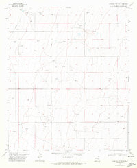
1970 Map of Hillburn City
USGS Topo · Published 1972About this map
Morton Field and a network of energy infrastructure define this section of the High Plains in the early 1970s. The landscape is characterized by a sparse but systematic industrial presence, where numerous Oil Wells and Drill Holes are connected by a prominent Pipeline running through the southern half of the quadrangle. This pattern reflects the mid-century intensification of petroleum exploration across Lea County.
Find a feature on this map
12 named features on this map. Tap any name to fly to it.
Don’t see what you’re looking for? This feature index may not catch every label — zoom into the map to look around manually.
Map Details
Editions of this 1970 Hillburn City Map
Other maps of this area

1954 · Hobbs
USGS Topo · 1:250,000

1954 · Brownfield
USGS Topo · 1:250,000

1958 · Brownfield
USGS Topo · 1:250,000

1958 · Hobbs
USGS Topo · 1:250,000

1962 · Brownfield
USGS Topo · 1:250,000

1962 · Lovington
USGS Topo · 1:24,000

1962 · Lovington
USGS Topo · 1:62,500

1970 · Prairieview
USGS Topo · 1:24,000

1970 · Prairieview NW
USGS Topo · 1:24,000

1970 · Hillburn City
USGS Topo · 1:24,000