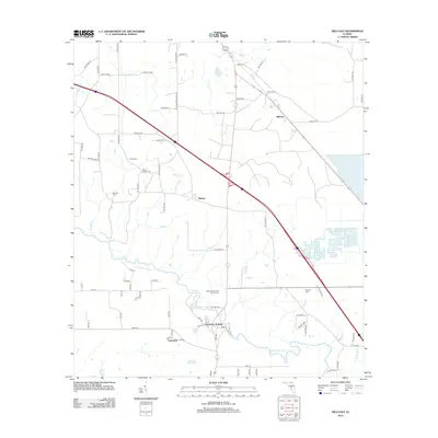
2012 Map of Hillcoat
USGS Topo · Published 2012About this map
The Suwannee River carves a winding path through this northern Florida landscape, anchoring settlements like Suwannee Springs and Suwannee. The presence of Old Marion Station Rd near the community of Marion points to the area's rail history and its evolution into a network of country roads. Small family and community burial grounds, including Nunn Cem, Mount Pisgah Cem, and Mitchell Cem, are scattered across the terrain, providing essential landmarks for genealogical research in Hamilton County. North of the river, the landscape is defined by several creek systems such as Cat Cr and Mitchell Cr, while the community of Hillcoat sits near the intersection of several local routes. This 2012 survey illustrates a region where rural residential life and recreation at the Highland Fairways Golf Course coexist with traditional land use patterns.
Find a feature on this map
78 named features on this map. Tap any name to fly to it.
Don’t see what you’re looking for? This feature index may not catch every label — zoom into the map to look around manually.
Map Details
Editions of this 2012 Hillcoat Map
This is the sole edition of this map. No revisions or reprints were ever made.
Other maps of this area

1954 · Valdosta
USGS Topo · 1:250,000

1955 · Jasper
USGS Topo · 1:24,000

1955 · Cypress Creek
USGS Topo · 1:24,000

1956 · Jennings
USGS Topo · 1:24,000

1958 · Valdosta
USGS Topo · 1:250,000

1958 · Fort Union
USGS Topo · 1:24,000

1959 · Valdosta
USGS Topo · 1:250,000

1959 · Live Oak West
USGS Topo · 1:24,000

1961 · Live Oak East
USGS Topo · 1:24,000

1961 · Hillcoat
USGS Topo · 1:24,000