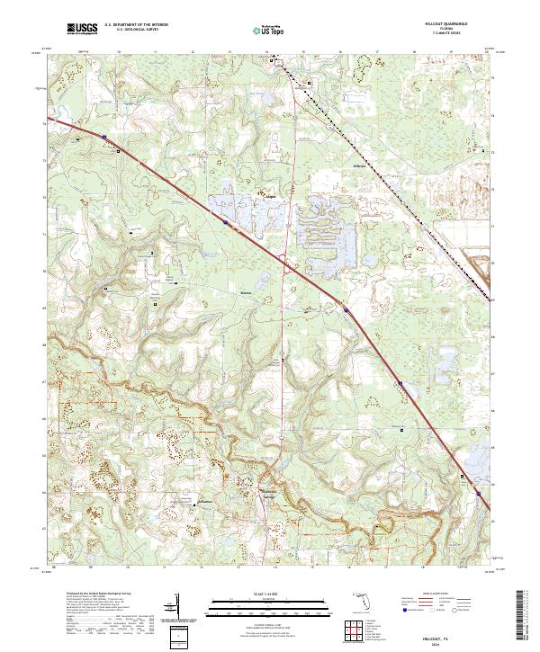
2024 Map of Hillcoat
USGS Topo · Published 2024About this map
The Suwannee River carves a deep path through the limestone-rich terrain of Hamilton County, defining the southern reaches of this landscape. Near the river’s bend, the historic site of Suwannee Springs stands as a focal point, surrounded by conservation lands and the winding Florida National Scenic Trail. The map reveals a high concentration of family and community burial grounds, including the Marion Plantation Cem, Ross - Roux Cem, and Frink - Peeples McCall Cem, which offer significant data for genealogical research in this rural pocket of North Florida.
Find a feature on this map
98 named features on this map. Tap any name to fly to it.
Don’t see what you’re looking for? This feature index may not catch every label — zoom into the map to look around manually.
Map Details
Editions of this 2024 Hillcoat Map
This is the sole edition of this map. No revisions or reprints were ever made.
Other maps of this area

1954 · Valdosta
USGS Topo · 1:250,000

1955 · Jasper
USGS Topo · 1:24,000

1955 · Cypress Creek
USGS Topo · 1:24,000

1956 · Jennings
USGS Topo · 1:24,000

1958 · Valdosta
USGS Topo · 1:250,000

1958 · Fort Union
USGS Topo · 1:24,000

1959 · Valdosta
USGS Topo · 1:250,000

1959 · Live Oak West
USGS Topo · 1:24,000

1961 · Live Oak East
USGS Topo · 1:24,000

1961 · Hillcoat
USGS Topo · 1:24,000