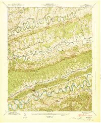
1939 Map of Hilton
USGS Topo · Published 1939About this map
Dorton Fort stands as a landmark of early frontier history near the winding path of Copper Creek. This late-1930s landscape in Scott County is defined by a series of dramatic, parallel ridges including Moccasin Ridge, Clinch Mountain, and Little Pine Ridge. The Southern railroad line tracks through the narrow corridor of Poor Valley, connecting small whistle-stops like Hilton and Fulkerson.
Find a feature on this map
79 named features on this map. Tap any name to fly to it.
Don’t see what you’re looking for? This feature index may not catch every label — zoom into the map to look around manually.
Map Details
Editions of this 1939 Hilton Map
2 editions found
Other maps of this area

1894 · Estillville
USGS Topo · 1:125,000

1897 · Bristol
USGS Topo · 1:125,000

1902 · Bristol
USGS Topo · 1:125,000

1920 · Wise
USGS Topo · 1:48,000

1920 · Coeburn
USGS Topo · 1:48,000

1921 · Wise
USGS Topo · 1:62,500

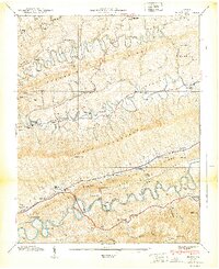
1935 · Hilton
USGS Topo · 1:24,000

1935 · Moggasin
USGS Topo · 1:48,000

1935 · Mendota
USGS Topo · 1:24,000

1935 · Blountville
USGS Topo · 1:24,000