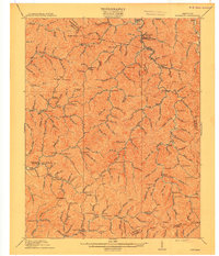
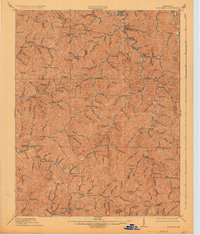
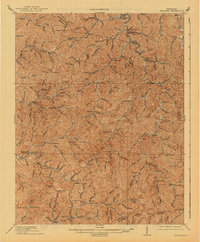
1915 Map of Hindman
USGS Topo · Published 1915About this map
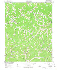
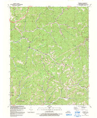
Hindman sits at the heart of this Kentucky landscape, where the headwaters of Troublesome Creek and the Middle Fork Quicksand Creek carve through the steep terrain of the Cumberland Plateau. This 1912 survey, published shortly before the region's coal industry underwent significant expansion, documents a network of small agricultural settlements and timber-rich hollows. The map reveals an intricate system of rural education, identifying over a dozen specific school sites such as Quicksand School and School No 12 that served these isolated mountain communities.
Find a feature on this map
132 named features on this map. Tap any name to fly to it.
Don’t see what you’re looking for? This feature index may not catch every label — zoom into the map to look around manually.
Map Details
Editions of this 1915 Hindman Map
4 editions found
Historical Maps of Hindman Through Time
9 maps found