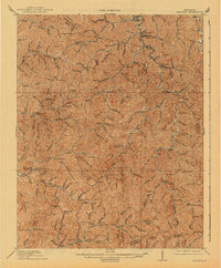
1915 Map of Hindman
USGS Topo · Published 1941About this map
Hindman sits at the heart of this 1912 survey, appearing as a vital hub in the deeply dissected plateau of Eastern Kentucky. The landscape is defined by an intricate network of narrow hollows and steep ridges, where life centered around the forks of Troublesome Creek and the Middle Fork Quicksand Creek. A striking feature of this era is the sheer number of numbered schoolhouses scattered through the mountains, such as School No 14 and School No 12, indicating a highly localized social structure where every creek branch maintained its own educational center.
Find a feature on this map
80 named features on this map. Tap any name to fly to it.
Don’t see what you’re looking for? This feature index may not catch every label — zoom into the map to look around manually.
Map Details
Editions of this 1915 Hindman Map
4 editions found


Other maps of this area

1886 · Prestonsburg
USGS Topo · 1:125,000

1889 · Salyersville
USGS Topo · 1:125,000

1890 · Whitesburg
USGS Topo · 1:125,000

1891 · Hazard
USGS Topo · 1:125,000

1891 · Salyersville
USGS Topo · 1:125,000

1892 · Whitesburg
USGS Topo · 1:125,000

1892 · Prestonsburg
USGS Topo · 1:125,000

1899 · Salyersville
USGS Topo · 1:125,000

1912 · Pound
USGS Topo · 1:48,000

1912 · Hindman
USGS Topo · 1:48,000