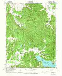
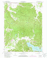
1961 Map of Hindustan
USGS Topo · Published 1963About this map
The Morgan-Monroe State Forest dominates this section of southern Indiana, preserving a landscape of deep hollows and prominent ridges such as Pea Ridge and Hacker Ridge. The 1961 survey provides a clear view of the area prior to extensive modern development, highlighting the small settlements of Hindustan and Fleener that once served the local rural population. To the south, the expansive Lake Lemon is a central feature, showing Riddle Point and Cemetery Island alongside residential routes like North Shore Drive.
Find a feature on this map
72 named features on this map. Tap any name to fly to it.
Don’t see what you’re looking for? This feature index may not catch every label — zoom into the map to look around manually.
Map Details
Editions of this 1961 Hindustan Map
5 editions found
Other maps of this area

1908 · Bloomington
USGS Topo · 1:48,000

1910 · Bloomington
USGS Topo · 1:62,500

1942 · Franklin
USGS Topo · 1:125,000

1946 · Belmont
USGS Topo · 1:24,000

1947 · Unionville
USGS Topo · 1:24,000

1948 · Hindustan
USGS Topo · 1:24,000

1948 · Morgantown
USGS Topo · 1:24,000

1950 · Belmont
USGS Topo · 1:24,000

1950 · Morgantown
USGS Topo · 1:24,000

1953 · Indianapolis
USGS Topo · 1:250,000