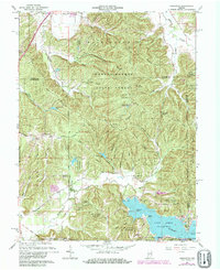
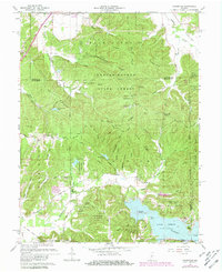
1961 Map of Hindustan
USGS Topo · Published 1981About this map
Lake Lemon dominates the southern landscape of this 1961 survey, showing the shoreline as it appeared shortly after its mid-century creation. The surrounding terrain is defined by the extensive Morgan-Monroe State Forest, where numerous ridges and hollows are named for local families and landmarks. Historical transport and land divisions are visible through the Old Indian Treaty Boundary cutting across the southwest corner and an Old Railroad Grade in the northeast near Indian Creek. The map documents small settlements like Hindustan and Farr, along with essential community fixtures such as Liberty Ch and several family burial grounds, including Taylor Cem and Stepp Cem. This edition includes purple revisions from 1977, illustrating the growth of recreation areas like the Wheeler Mission Campground and the Mason Ridge Camping Area near the Lookout Tower.
Find a feature on this map
73 named features on this map. Tap any name to fly to it.
Don’t see what you’re looking for? This feature index may not catch every label — zoom into the map to look around manually.
Map Details
Editions of this 1961 Hindustan Map
5 editions found
Other maps of this area

1908 · Bloomington
USGS Topo · 1:48,000

1910 · Bloomington
USGS Topo · 1:62,500

1942 · Franklin
USGS Topo · 1:125,000

1946 · Belmont
USGS Topo · 1:24,000

1947 · Unionville
USGS Topo · 1:24,000

1948 · Hindustan
USGS Topo · 1:24,000

1948 · Morgantown
USGS Topo · 1:24,000

1950 · Belmont
USGS Topo · 1:24,000

1950 · Morgantown
USGS Topo · 1:24,000

1953 · Indianapolis
USGS Topo · 1:250,000