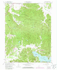
1961 Map of Hindustan
USGS Topo · Published 1981About this map
Hindustan and its surrounding ridge-and-valley landscape are captured here in a 1961 revision of earlier 1940s surveys. The settlement sits amidst a complex network of waterways, including Beanblossom Creek and Little Indian Creek, illustrating the early reliance on natural drainage patterns for local orientation and property boundaries. The map reflects a landscape in transition, with purple-ink revisions from 1977 aerial photography revealing late 20th-century developments in land use and infrastructure superimposed over the older topographic baseline.
Find a feature on this map
6 named features on this map. Tap any name to fly to it.
Don’t see what you’re looking for? This feature index may not catch every label — zoom into the map to look around manually.
Map Details
Editions of this 1961 Hindustan Map
5 editions found

Other maps of this area

1908 · Bloomington
USGS Topo · 1:48,000

1910 · Bloomington
USGS Topo · 1:62,500

1942 · Franklin
USGS Topo · 1:125,000

1946 · Belmont
USGS Topo · 1:24,000

1947 · Unionville
USGS Topo · 1:24,000

1948 · Hindustan
USGS Topo · 1:24,000

1948 · Morgantown
USGS Topo · 1:24,000

1950 · Belmont
USGS Topo · 1:24,000

1950 · Morgantown
USGS Topo · 1:24,000

1953 · Indianapolis
USGS Topo · 1:250,000