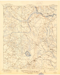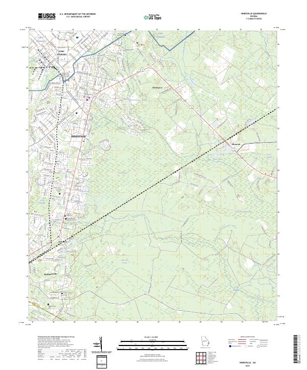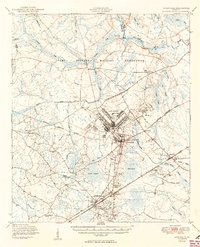
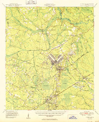
1950 Map of Hinesville
USGS Topo · Published 1950About this map
The Camp Stewart Military Reservation dominates this coastal plain landscape, where sprawling cantonments and a network of Observation Towers signify the rapid military buildup of the mid-century. While the army facility occupies the central terrain, the surrounding area retains its traditional rural Georgia character, defined by extensive wetlands such as Davis Swamp and McIntosh Swamp. Transportation centers on the Atlantic Coast Line and Seaboard Air Line railroads, which connect established communities like Hinesville, Flemington, and Allenhurst. Genealogists will find a high density of rural infrastructure, including Shiloh Sch, Taylors Creek Church, and numerous small family burial grounds like the Wells Cem and Cypress Slash Cem. The geography is intricately carved by the Canoochee River and Taylors Creek, creating a landscape where water and wood supported local industry at sites like Terrells Millpond.
Find a feature on this map
63 named features on this map. Tap any name to fly to it.
Don’t see what you’re looking for? This feature index may not catch every label — zoom into the map to look around manually.
Map Details
Editions of this 1950 Hinesville Map
2 editions found
Historical Maps of Hinesville Through Time
9 maps found