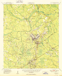
1950 Map of Hinesville
USGS Topo · Published 1950About this map
Camp Stewart Military Reservation dominates the northern half of this 1950 survey, showcasing a landscape in transition as military expansion met established rural Georgia communities. The sprawling base includes complex infrastructure like a Landing Field, Firing Range, and multiple Observation Towers. To the south, the county seat of Hinesville serves as the hub for surrounding settlements like Flemington and Allenhurst, which are connected by the Atlantic Coast Line and Seaboard Air Line railroads.
Find a feature on this map
70 named features on this map. Tap any name to fly to it.
Don’t see what you’re looking for? This feature index may not catch every label — zoom into the map to look around manually.
Map Details
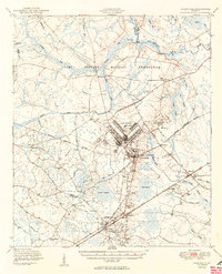
Editions of this 1950 Hinesville Map
2 editions found
Other maps of this area

1918 · Jesup
USGS Topo · 1:62,500

1918 · Hinesville
USGS Topo · 1:62,500

1919 · Claxton
USGS Topo · 1:62,500

1920 · Pembroke
USGS Topo · 1:62,500

1920 · Glennville
USGS Topo · 1:62,500

1920 · Meldrim
USGS Topo · 1:62,500

1920 · Sapelo River
USGS Topo · 1:62,500

1920 · Limerick
USGS Topo · 1:62,500

1942 · Meldrim
USGS Topo · 1:62,500

1943 · Ludowici
USGS Topo · 1:62,500