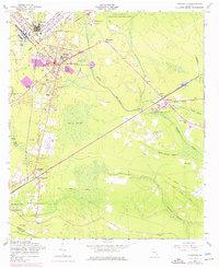
1958 Map of Hinesville
USGS Topo · Published 1976About this map
Hinesville sits at a geographic crossroads on the edge of the Fort Stewart Military Reservation, showing a landscape defined by the expansion of military and civilian life in the mid-20th century. The town center is anchored by the Bradwell Institute High School and surrounded by a network of swampy lowlands, including Melvin Swamp and the expansive Davis Swamp. These natural barriers shaped the settlement patterns of nearby communities like Flemington and McIntosh, where rural churches such as Wilderness Ch and St Peters Ch served as local landmarks.
Find a feature on this map
46 named features on this map. Tap any name to fly to it.
Don’t see what you’re looking for? This feature index may not catch every label — zoom into the map to look around manually.
Map Details
Editions of this 1958 Hinesville Map
3 editions found
Other maps of this area

1918 · Hinesville
USGS Topo · 1:62,500

1920 · Sapelo River
USGS Topo · 1:62,500

1920 · Limerick
USGS Topo · 1:62,500

1943 · Ludowici
USGS Topo · 1:62,500

1943 · Sapelo River
USGS Topo · 1:62,500

1944 · Hinesville
USGS Topo · 1:62,500

1944 · Limerick
USGS Topo · 1:62,500

1945 · Sapelo River
USGS Topo · 1:62,500

1946 · Brunswick
USGS Topo · 1:250,000

1948 · Brunswick
USGS Topo · 1:250,000