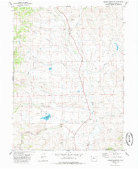
1980 Map of Hinman Reservoir
USGS Topo · Published 1985About this map
Muddy Creek flows through this high-altitude drainage basin north of the Colorado River during the late 1970s. The landscape is defined by its complex water management and ranching infrastructure, evidenced by the Mc Mahon Ditch and a network of named drainages like Pass Creek, Slough Creek, and Red Dirt Creek. The Hinman Reservoir serves as a central hydrological feature, while the presence of a lone Cem and scattered Drift Holes or Drill Holes suggest a history of local burial sites and resource exploration. Fences, marked by fine dashed lines, crisscross the terrain near Wolford Mountain, revealing the managed nature of this open range. This survey captures a moment when traditional land use, from grazing to gravel extraction at the various Gravel Pits, remained the primary activity in this portion of Grand County.
Find a feature on this map
24 named features on this map. Tap any name to fly to it.
Don’t see what you’re looking for? This feature index may not catch every label — zoom into the map to look around manually.
Map Details
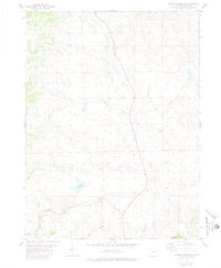
Editions of this 1980 Hinman Reservoir Map
2 editions found
Other maps of this area

1954 · Craig
USGS Topo · 1:250,000

1956 · Lake Agnes
USGS Topo · 1:24,000

1956 · Kremmling
USGS Topo · 1:62,500

1956 · Whiteley Peak
USGS Topo · 1:24,000

1956 · Hyannis Peak
USGS Topo · 1:24,000

1956 · Gore Pass
USGS Topo · 1:62,500

1956 · Hyannis Peak
USGS Topo · 1:62,500

1956 · Rabbit Ears Peak
USGS Topo · 1:62,500

1957 · Craig
USGS Topo · 1:250,000

1958 · Craig
USGS Topo · 1:250,000