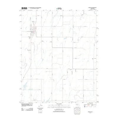
2013 Map of Hinton
USGS Topo · Published 2013About this map
Hinton serves as the primary hub of this landscape in Caddo County, organized around a traditional street grid and the north-south corridor of Railway Ave. The surrounding rural territory is defined by a series of north-south drainage networks including Kickapoo Cr, Buggy Cr, and Sugar Cr, which lead toward the Canadian River at the northeastern corner. This period shows a high density of water conservation efforts, evidenced by several reservoirs such as Fay Abbott Reservoir and the Fast Runner Site 4 Reservoir. Local heritage is anchored by a cluster of rural burying grounds, including Sacred Heart Cem, Constien Cem, and Saint Johns Cem, which suggest the historic locations of small rural communities and church parishes that once populated the township outside the main settlement. Near the eastern edge, the small community of Niles remains a distinct geographic point in the agricultural expanse.
Find a feature on this map
52 named features on this map. Tap any name to fly to it.
Don’t see what you’re looking for? This feature index may not catch every label — zoom into the map to look around manually.
Map Details
Editions of this 2013 Hinton Map
This is the sole edition of this map. No revisions or reprints were ever made.
Other maps of this area

1893 · Fort Reno
USGS Topo · 1:62,500

1893 · Buggy Creek
USGS Topo · 1:62,500

1941 · Fort Reno
USGS Topo · 1:62,500

1942 · Fort Reno
USGS Topo · 1:62,500

1942 · Geary
USGS Topo · 1:62,500

1949 · Fort Reno
USGS Topo · 1:62,500

1951 · Binger
USGS Topo · 1:62,500

1955 · Clinton
USGS Topo · 1:250,000

1957 · Clinton
USGS Topo · 1:250,000

1967 · Fort Reno SW
USGS Topo · 1:24,000