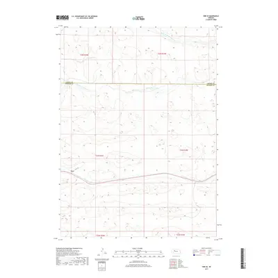
2017 Map of Hire SE
USGS Topo · Published 2017About this map
The small settlement of Weir serves as the focal point of this remote corner of the Nebraska Sandhills, positioned where the High Plains landscape meets the marshy basins of the Loup River system. The terrain is defined by the bifurcating waters of the Middle Br Middle Loup River and the S Br Middle Loup River, which carve distinct paths through the surrounding dunes. These watercourses provide critical riparian habitat and orientation in a region largely characterized by its rhythmic, undulating topography. The map illustrates the sparsely populated nature of the area, where human infrastructure is limited to solitary corridors like N Hecla Rd and the straight-line divisions of the Public Land Survey System, such as the boundary between Cherry and Hooker Counties.
Find a feature on this map
11 named features on this map. Tap any name to fly to it.
Don’t see what you’re looking for? This feature index may not catch every label — zoom into the map to look around manually.
Map Details
Editions of this 2017 Hire SE Map
This is the sole edition of this map. No revisions or reprints were ever made.
Other maps of this area

1947 · Dismal River Ranch
USGS Topo · 1:62,500

1948 · Carr Lake
USGS Topo · 1:62,500

1948 · Mullen
USGS Topo · 1:62,500

1949 · Dismal River Ranch
USGS Topo · 1:62,500

1950 · Carr Lake
USGS Topo · 1:62,500

1950 · Hire
USGS Topo · 1:62,500

1951 · Mullen
USGS Topo · 1:62,500

1954 · North Platte
USGS Topo · 1:250,000

1956 · North Platte
USGS Topo · 1:250,000

1957 · North Platte
USGS Topo · 1:250,000