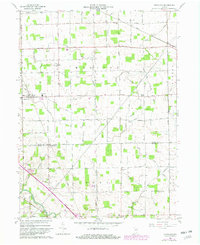
1961 Map of Hoagland
USGS Topo · Published 1982About this map
Hoagland serves as the primary hub of this agricultural landscape in southeastern Allen County, defined by a rigid grid of rural roads and an extensive network of drainage features. The Conrail line cuts diagonally across the northern sections, passing through the small settlement of Boston Corner and connecting the region to larger industrial centers. The importance of local education and faith is evident in the cluster of community buildings, including Consolidated Sch, St Johns Sch, and St Peters Sch, which anchored family life for generations of residents.
Find a feature on this map
67 named features on this map. Tap any name to fly to it.
Don’t see what you’re looking for? This feature index may not catch every label — zoom into the map to look around manually.
Map Details
Editions of this 1961 Hoagland Map
Other maps of this area

1953 · Fort Wayne
USGS Topo · 1:250,000

1953 · Muncie
USGS Topo · 1:250,000

1956 · Muncie
USGS Topo · 1:250,000

1956 · Fort Wayne
USGS Topo · 1:250,000

1956 · Fort Wayne East
USGS Topo · 1:24,000

1957 · Maples
USGS Topo · 1:24,000

1958 · Woodburn South
USGS Topo · 1:24,000

1960 · Dixon
USGS Topo · 1:24,000
1960 · Wren
USGS Topo · 1:24,000

1961 · Hoagland
USGS Topo · 1:24,000