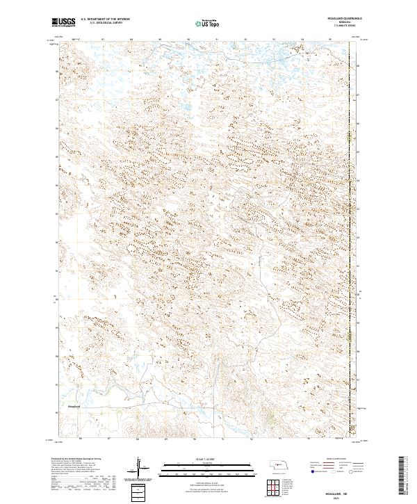
2021 Map of Hoagland
USGS Topo · Published 2021About this map
The S Loup River meanders through the southern portion of this Nebraska landscape, providing a vital water source for the settlement of Hoagland. This area in Logan County is characterized by the rolling sandhills of the Great Plains, where the terrain is dominated by complex contour patterns and drainage basins. Remote gravel routes like Halstead Ln and 408 Rd navigate the section lines of the Public Land Survey System, which remains the primary grid for property and movement in this part of the state. Near the eastern edge, the Logan Co Custer Co boundary marks the transition into the neighboring county, while the river valley provides the most significant relief in an otherwise expansive and undulating prairie environment.
Find a feature on this map
11 named features on this map. Tap any name to fly to it.
Don’t see what you’re looking for? This feature index may not catch every label — zoom into the map to look around manually.
Map Details
Editions of this 2021 Hoagland Map
This is the sole edition of this map. No revisions or reprints were ever made.
Other maps of this area

1948 · Linscott
USGS Topo · 1:62,500

1950 · Linscott
USGS Topo · 1:62,500

1951 · Hoagland
USGS Topo · 1:62,500

1954 · North Platte
USGS Topo · 1:250,000

1956 · North Platte
USGS Topo · 1:250,000

1957 · North Platte
USGS Topo · 1:250,000

1967 · North Platte
USGS Topo · 1:250,000

1972 · Logan
USGS Topo · 1:24,000

1972 · Arnold
USGS Topo · 1:24,000
1972 · Gandy
USGS Topo · 1:24,000