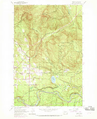
1953 Map of Hobart
USGS Topo · Published 1969About this map
Hobart and the surrounding timber and mining country of King County are documented here during a period of transition, following the 1953 survey with 1968 photorevisions. The map highlights the critical infrastructure of the Cedar River Watershed, showing the Seattle Water Supply Intake at Landsburg and the protected lands surrounding Walsh Lake. Industrial heritage is visible through the Chicago Milwaukee St Paul and Pacific railroad and numerous railroad grades that once serviced the logging and mining operations. Resource extraction and early processing are evident at the Tiger Mtn Mine and a Shingle Mill located along Carey Creek. The settlement of Taylor (Site) is noted as a former location, while local community life is anchored by the Hobart Sch and nearby rural road networks like Iss-South Ravensdale Rd.
Find a feature on this map
45 named features on this map. Tap any name to fly to it.
Don’t see what you’re looking for? This feature index may not catch every label — zoom into the map to look around manually.
Map Details
Editions of this 1953 Hobart Map
4 editions found

Other maps of this area

1895 · Snohomish
USGS Topo · 1:125,000

1897 · Tacoma
USGS Topo · 1:125,000

1897 · Seattle
USGS Topo · 1:125,000

1900 · Tacoma
USGS Topo · 1:125,000

1913 · Cedar Lake
USGS Topo · 1:125,000

1921 · Sultan
USGS Topo · 1:125,000

1923 · Sultan
USGS Topo · 1:125,000

1949 · Maple Valley
USGS Topo · 1:24,000

1949 · Black Diamond
USGS Topo · 1:24,000

1950 · Issaquah
USGS Topo · 1:24,000