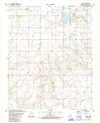
1987 Map of Hocker
USGS Topo · Published 1987About this map
The Oklahoma energy landscape is clearly visible here, defined by the Gas Field, Merritt Field, and Poarch Field that punctuate the rolling plains of Beckham County. These industrial zones are layered over an older agricultural and transport network, featuring the winding course of Elk Creek and the man-made Lake Elk City. The infrastructure of the late twentieth century is prominent, showing the transition from the Old Railroad Grade to active lines like the Farmrail. Near the center of the sheet, the small settlement of Hocker sits at a rural crossroads, while the outskirts of Elk City occupy the northeastern corner. Local history is anchored by the Seventh-day Adventist Ch, Bellview Cem, and Ural Cem, which serve as landmarks for genealogists tracing families in this part of western Oklahoma.
Find a feature on this map
26 named features on this map. Tap any name to fly to it.
Don’t see what you’re looking for? This feature index may not catch every label — zoom into the map to look around manually.
Map Details
Editions of this 1987 Hocker Map
This is the sole edition of this map. No revisions or reprints were ever made.
Other maps of this area

1955 · Clinton
USGS Topo · 1:250,000

1957 · Clinton
USGS Topo · 1:250,000

1960 · Sayre
USGS Topo · 1:62,500

1961 · Willow
USGS Topo · 1:62,500

1961 · Retrop
USGS Topo · 1:62,500

1961 · Elk City
USGS Topo · 1:62,500

1985 · Elk City
USGS Topo · 1:100,000

1987 · Elk City
USGS Topo · 1:24,000
1987 · Canute
USGS Topo · 1:24,000
1987 · Elk City SE
USGS Topo · 1:24,000