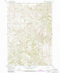
1966 Map of Hodsdon Flats
USGS Topo · Published 1986About this map
Custer National Forest encompasses much of this landscape in Powder River County, where the terrain is defined by a dense network of drainages and seasonal water sources. The map reveals an area reliant on localized water management for ranching and land use, evidenced by features like Turtle Reservoir and Callaway Reservoir. The topography is marked by distinctive rises such as Gardner Butte and Bailey Hill, which overlook complex draws and prongs including Sawmill Draw, Maverick Prong, and Schwind Draw. Numerous named springs, such as Mason Spring, Deadman Spring, and Fence Corner Spring, indicate the vital points of water access that sustained operations within the Hodsdon Flats area. The branching headwaters of Bloom Creek and the South Fork of Cache Creek illustrate the natural erosion patterns that have shaped this portion of the Montana backcountry during the mid-20th century.
Find a feature on this map
27 named features on this map. Tap any name to fly to it.
Don’t see what you’re looking for? This feature index may not catch every label — zoom into the map to look around manually.
Map Details
Editions of this 1966 Hodsdon Flats Map
2 editions found
Other maps of this area

1954 · Ekalaka
USGS Topo · 1:250,000

1956 · Ekalaka
USGS Topo · 1:250,000

1958 · Ekalaka
USGS Topo · 1:250,000

1965 · Ekalaka
USGS Topo · 1:250,000

1966 · Sonnette
USGS Topo · 1:24,000

1966 · Phillips Butte
USGS Topo · 1:24,000

1966 · Hodsdon Flats
USGS Topo · 1:24,000

1966 · Threemile Buttes
USGS Topo · 1:24,000

1970 · Bloom Creek
USGS Topo · 1:24,000

1970 · Huckins School
USGS Topo · 1:24,000