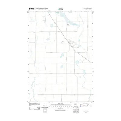
2010 Map of Hoffman
USGS Topo · Published 2010About this map
Hoffman serves as the central hub for this rural Grant County landscape, where the local economy and social life are anchored by the intersection of state and county highways. The settlement is clearly defined by its street grid, including 1st St S and 3rd St N, and the presence of the Hoffman Post Office. A trio of burial grounds—Zion Cemetery, Land Cemetery, and Bethel Cemetery—cluster near the town center, offering significant touchstones for genealogical research in the region.
Find a feature on this map
44 named features on this map. Tap any name to fly to it.
Don’t see what you’re looking for? This feature index may not catch every label — zoom into the map to look around manually.
Map Details
Editions of this 2010 Hoffman Map
This is the sole edition of this map. No revisions or reprints were ever made.
Other maps of this area

1911 · Barrett
USGS Topo · 1:62,500

1912 · Morris
USGS Topo · 1:62,500

1953 · Saint Cloud
USGS Topo · 1:250,000

1957 · Saint Cloud
USGS Topo · 1:250,000

1958 · Saint Cloud
USGS Topo · 1:250,000

1966 · Kensington
USGS Topo · 1:24,000

1966 · Quam Lake
USGS Topo · 1:24,000

1968 · Starbuck NW
USGS Topo · 1:24,000
1973 · Patchen Lake
USGS Topo · 1:24,000
1973 · Pomme De Terre Lakes
USGS Topo · 1:24,000