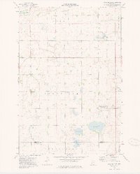
1973 Map of Patchen Lake
USGS Topo · Published 1975About this map
Glacial prairie potholes and marshy depressions define this landscape near the borders of Grant and Stevens Counties. In the early 1970s, the terrain was characterized by a high density of small water bodies and wetlands, many of which were protected under the National Waterfowl Production Area designation. These prairie wetlands, including Patchen Lake, Shauer Lake, and Jones Lake, are interspersed among section lines and agricultural townships, reflecting a land-use pattern where nature conservation and rural cultivation coexist.
Find a feature on this map
12 named features on this map. Tap any name to fly to it.
Don’t see what you’re looking for? This feature index may not catch every label — zoom into the map to look around manually.
Map Details
Editions of this 1973 Patchen Lake Map
This is the sole edition of this map. No revisions or reprints were ever made.
Other maps of this area

1910 · Chokio
USGS Topo · 1:62,500

1911 · Barrett
USGS Topo · 1:62,500

1911 · Herman
USGS Topo · 1:62,500

1912 · Chokio
USGS Topo · 1:62,500

1912 · Morris
USGS Topo · 1:62,500

1953 · Milbank
USGS Topo · 1:250,000

1953 · Saint Cloud
USGS Topo · 1:250,000

1957 · Saint Cloud
USGS Topo · 1:250,000

1958 · Milbank
USGS Topo · 1:250,000

1958 · Saint Cloud
USGS Topo · 1:250,000