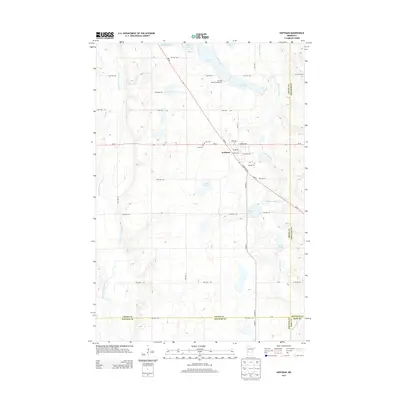
2013 Map of Hoffman
USGS Topo · Published 2013About this map
The settlement of Hoffman serves as the focal point of this Grant County landscape, positioned where MN-55 and MN-27 intersect. This area is defined by a glacial terrain of prairie lakes and bifurcated drainage, with the Pomme de Terre River flowing through the western portion of the quadrangle while the Chippewa River winds through the east. These watercourses have historically dictated the placement of roads and farmsteads in this portion of West Central Minnesota.
Find a feature on this map
47 named features on this map. Tap any name to fly to it.
Don’t see what you’re looking for? This feature index may not catch every label — zoom into the map to look around manually.
Map Details
Editions of this 2013 Hoffman Map
This is the sole edition of this map. No revisions or reprints were ever made.
Other maps of this area

1911 · Barrett
USGS Topo · 1:62,500

1912 · Morris
USGS Topo · 1:62,500

1953 · Saint Cloud
USGS Topo · 1:250,000

1957 · Saint Cloud
USGS Topo · 1:250,000

1958 · Saint Cloud
USGS Topo · 1:250,000

1966 · Kensington
USGS Topo · 1:24,000

1966 · Quam Lake
USGS Topo · 1:24,000

1968 · Starbuck NW
USGS Topo · 1:24,000
1973 · Patchen Lake
USGS Topo · 1:24,000
1973 · Pomme De Terre Lakes
USGS Topo · 1:24,000