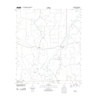
2012 Map of Holden
USGS Topo · Published 2012About this map
Tickfaw River winds southward through this part of Livingston Parish, serving as a central geographic anchor for small communities like Magnolia and Starns. The landscape is characterized by a dense network of watercourses, including Bear Cr and Crooked Cr, which historically dictated the pattern of early settlement and road placement. The prevalence of family-named cemeteries such as Bankston Cem, Courtney Cem, and Howze Cem offers significant genealogical value, marking the homesteads of established local families.
Find a feature on this map
99 named features on this map. Tap any name to fly to it.
Don’t see what you’re looking for? This feature index may not catch every label — zoom into the map to look around manually.
Map Details
Editions of this 2012 Holden Map
This is the sole edition of this map. No revisions or reprints were ever made.
Other maps of this area

1934 · Denham Springs
USGS Topo · 1:62,500

1934 · Springfield
USGS Topo · 1:62,500

1939 · Springfield
USGS Topo · 1:62,500

1939 · Denham Springs
USGS Topo · 1:62,500

1942 · Montpelier
USGS Topo · 1:31,680

1942 · Pine Grove
USGS Topo · 1:31,680

1942 · Satsuma
USGS Topo · 1:31,680

1949 · Amite
USGS Topo · 1:31,680

1949 · Albany
USGS Topo · 1:31,680

1950 · Doyle
USGS Topo · 1:31,680