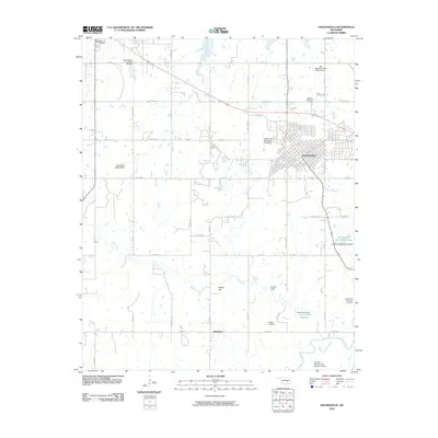
2010 Map of Holdenville
USGS Topo · Published 2010About this map
Holdenville serves as the primary urban center for this portion of Hughes County, situated at the intersection of a well-defined grid of section roads and regional arteries. The landscape south of town is defined by a series of water management sites, including the Holdenville Waterworks Lake and several dams such as the Lynn Peters Reservoir and the Ed Perry 1 Dam. These reservoirs, along with the Holdenville State Fish Hatchery, indicate a significant focus on local water infrastructure and conservation.
Find a feature on this map
46 named features on this map. Tap any name to fly to it.
Don’t see what you’re looking for? This feature index may not catch every label — zoom into the map to look around manually.
Map Details
Editions of this 2010 Holdenville Map
This is the sole edition of this map. No revisions or reprints were ever made.
Other maps of this area

1896 · Seminole and Prague
USGS Topo · 1:125,000

1896 · Coalgate
USGS Topo · 1:125,000

1899 · Coalgate
USGS Topo · 1:125,000

1900 · Wewoka
USGS Topo · 1:125,000

1900 · Coalgate
USGS Topo · 1:125,000

1901 · Stonewall
USGS Topo · 1:125,000

1954 · Oklahoma City
USGS Topo · 1:250,000

1957 · Ardmore
USGS Topo · 1:250,000

1957 · Oklahoma City
USGS Topo · 1:250,000

1958 · Sasakwa
USGS Topo · 1:24,000