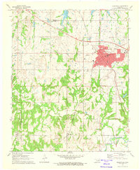
1972 Map of Holdenville
USGS Topo · Published 1974About this map
Holdenville serves as the focal point of this Oklahoma landscape, where the town grid is defined by streets like Hickory St and Main St. The town's infrastructure in the early 1970s is fully detailed, including the Holdenville Municipal Airport, Stroup Park, and various educational institutions such as the High School and Jr High School. The surrounding countryside reveals a region heavily shaped by the petroleum industry, with the Brown Oil Field, Lake Oil Field, and Jacobs Oil Field punctuated by countless individual Oil Wells.
Find a feature on this map
44 named features on this map. Tap any name to fly to it.
Don’t see what you’re looking for? This feature index may not catch every label — zoom into the map to look around manually.
Map Details
Editions of this 1972 Holdenville Map
This is the sole edition of this map. No revisions or reprints were ever made.
Other maps of this area

1896 · Seminole and Prague
USGS Topo · 1:125,000

1896 · Coalgate
USGS Topo · 1:125,000

1899 · Coalgate
USGS Topo · 1:125,000

1900 · Wewoka
USGS Topo · 1:125,000

1900 · Coalgate
USGS Topo · 1:125,000

1901 · Stonewall
USGS Topo · 1:125,000

1954 · Oklahoma City
USGS Topo · 1:250,000

1957 · Ardmore
USGS Topo · 1:250,000

1957 · Oklahoma City
USGS Topo · 1:250,000

1958 · Sasakwa
USGS Topo · 1:24,000