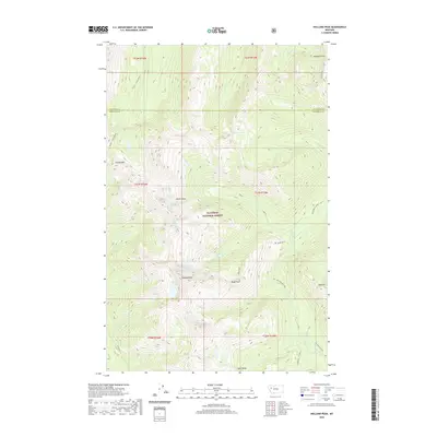
2020 Map of Holland Peak
USGS Topo · Published 2020About this map
Holland Peak and the high ridges of the Swan Range dominate this corner of the Flathead National Forest on the border of Missoula and Flathead Counties. This modern survey illustrates a landscape defined by dramatic elevation changes and a dense network of alpine water sources. The map identifies the remote Albino Basin and several high-altitude water bodies, including Sappho Lake, Rumble Cr Lake, and the Terrace Lakes. These features represent the headwaters for numerous drainage systems such as Big Salmon Creek and Little Salmon Cr. Peaks like Garnet Peak, Cooney Mtn, and Gyp Mtn stand as notable landmarks within this protected wilderness, while named points such as Brownie Point and Tango Point provide specific reference for those navigating the backcountry of Western Montana.
Find a feature on this map
39 named features on this map. Tap any name to fly to it.
Don’t see what you’re looking for? This feature index may not catch every label — zoom into the map to look around manually.
Map Details
Editions of this 2020 Holland Peak Map
This is the sole edition of this map. No revisions or reprints were ever made.
Other maps of this area

1902 · Ovando
USGS Topo · 1:125,000

1905 · Ovando
USGS Topo · 1:125,000

1921 · Elbow Lake
USGS Topo · 1:125,000

1936 · Silvertip
USGS Topo · 1:96,000

1942 · Silvertip
USGS Topo · 1:125,000

1955 · Choteau
USGS Topo · 1:250,000

1957 · Choteau
USGS Topo · 1:250,000

1958 · Choteau
USGS Topo · 1:250,000

1962 · Choteau
USGS Topo · 1:250,000

1965 · Condon
USGS Topo · 1:24,000