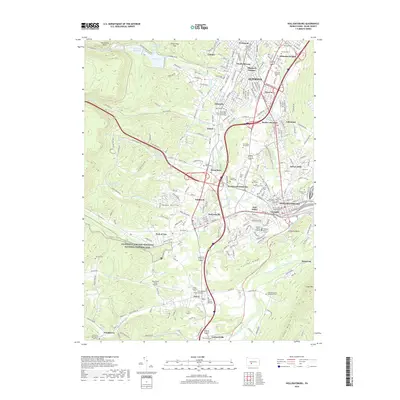
2019 Map of Hollidaysburg
USGS Topo · Published 2019About this map
Altoona and Hollidaysburg anchor this topographical study of the Allegheny Front, where the legacy of early trans-Appalachian transport remains visible. The Allegheny Portage Railroad National Historic Site preserves the corridor where canal boats were once hauled over the mountain, a feat of engineering that predated the modern rail dominance of the Norfolk Southern line seen winding through Kittanning Gap and around Kittanning Point. From the civic center at the Blair County Courthouse to the outlying industrial history at Allegheny Furnace, the landscape is a complex mix of urban density and steep valley terrain.
Find a feature on this map
231 named features on this map. Tap any name to fly to it.
Don’t see what you’re looking for? This feature index may not catch every label — zoom into the map to look around manually.
Map Details
Editions of this 2019 Hollidaysburg Map
This is the sole edition of this map. No revisions or reprints were ever made.
Other maps of this area

1902 · Ebensburg
USGS Topo · 1:62,500

1902 · Patton
USGS Topo · 1:62,500

1902 · Hollidaysburg
USGS Topo · 1:62,500

1903 · Hollidaysburg
USGS Topo · 1:62,500

1904 · Patton
USGS Topo · 1:62,500

1904 · Ebensburg
USGS Topo · 1:62,500

1920 · Altoona
USGS Topo · 1:62,500

1922 · Altoona
USGS Topo · 1:62,500

1943 · Punxsutawney
USGS Topo · 1:125,000

1953 · Pittsburgh
USGS Topo · 1:250,000