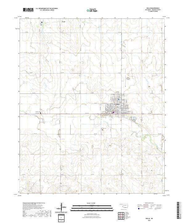
2022 Map of Hollis
USGS Topo · Published 2022About this map
Hollis stands as the primary hub of this landscape, anchored by the Harmon County Courthouse and a grid of residential streets like W Eula St and E Sycamore St. The surrounding terrain is defined by a systematic grid of section roads including e1610 RD and n1700 RD, which cut across the meandering paths of W Fork Sandy Cr and Bitter Cr. The small community of Arnett appears in the northern reaches, while several local burial grounds, including Fairmount Cem and Number 2 Cem, provide essential data points for those tracing regional family history. The presence of the Hollis Municipal Airport northeast of the town center highlights the area's continued role as a local center for transit and services in this part of southwestern Oklahoma.
Find a feature on this map
65 named features on this map. Tap any name to fly to it.
Don’t see what you’re looking for? This feature index may not catch every label — zoom into the map to look around manually.
Map Details
Editions of this 2022 Hollis Map
This is the sole edition of this map. No revisions or reprints were ever made.
Other maps of this area

1954 · Plainview
USGS Topo · 1:250,000

1955 · Lawton
USGS Topo · 1:250,000

1958 · Plainview
USGS Topo · 1:250,000

1960 · Loco
USGS Topo · 1:62,500

1961 · Hollis
USGS Topo · 1:62,500

1964 · Dodson
USGS Topo · 1:24,000
1971 · Mc Knight
USGS Topo · 1:24,000
1971 · Shrewder
USGS Topo · 1:24,000

1975 · Hollis NE
USGS Topo · 1:24,000

1975 · Hollis SE
USGS Topo · 1:24,000