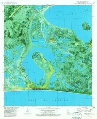
1982 Map of Holly Beach
USGS Topo · Published 1982About this map
Sabine National Wildlife Refuge dominates this 1982 orthophotomap, showing the intricate wetland patterns and coastal marshes along the Gulf of Mexico. The coastal settlement of Holly Beach serves as a small anchor on the shoreline, positioned south of the extensive Mud Lake and the West Cove of Calcasieu Lake. The map reveals a landscape heavily integrated with the mid-20th-century energy industry, featuring the Mud Lake Gas Field, East Mud Lake Gas Field, and East Holly Beach Gas Field.
Find a feature on this map
30 named features on this map. Tap any name to fly to it.
Don’t see what you’re looking for? This feature index may not catch every label — zoom into the map to look around manually.
Map Details
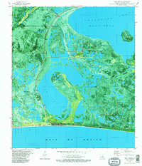
Editions of this 1982 Holly Beach Map
2 editions found
Other maps of this area

1934 · Cameron
USGS Topo · 1:24,000

1934 · Holly Beach
USGS Topo · 1:24,000

1934 · Peveto Beach
USGS Topo · 1:24,000

1934 · Browns Lake
USGS Topo · 1:24,000

1934 · Five Lakes
USGS Topo · 1:24,000

1935 · Peveto Beach
USGS Topo · 1:31,680

1935 · Cameron
USGS Topo · 1:31,680

1935 · Five Lakes
USGS Topo · 1:31,680

1935 · Hackberry
USGS Topo · 1:31,680

1935 · Holly Beach
USGS Topo · 1:31,680