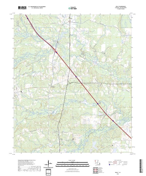
2024 Map of Holly
USGS Topo · Published 2024About this map
Frierson and Holly anchor this De Soto Parish landscape, where the winding tributaries of the Red River basin define the local topography. This modern survey illustrates a rural corridor characterized by dispersed settlements and numerous family and community burial grounds, such as Saint Francois Cem and the Mount Mariah Church Cem. The drainage patterns of McGee Bayou and Bayou Na Bonchasse dominate the central and southern sections, revealing how water management and natural lowlands have shaped land use. The road network, including State Rte 5 and numerous parish roads like Bethel Rd, connects these small communities to the surrounding timber and agricultural lands of northwest Louisiana. Genealogists will find the detailed locations of rural churches and cemeteries particularly valuable for tracing local family histories in this region.
Find a feature on this map
77 named features on this map. Tap any name to fly to it.
Don’t see what you’re looking for? This feature index may not catch every label — zoom into the map to look around manually.
Map Details
Editions of this 2024 Holly Map
This is the sole edition of this map. No revisions or reprints were ever made.
Other maps of this area

1945 · Grand Cane
USGS Topo · 1:62,500

1945 · Greenwood
USGS Topo · 1:62,500

1945 · Mansfield
USGS Topo · 1:62,500

1947 · Mansfield
USGS Topo · 1:62,500

1948 · Caspiana
USGS Topo · 1:62,500

1955 · Shreveport
USGS Topo · 1:250,000

1955 · Caspiana
USGS Topo · 1:62,500

1955 · Greenwood
USGS Topo · 1:62,500

1956 · Shreveport
USGS Topo · 1:250,000
1957 · Grand Cane
USGS Topo · 1:62,500