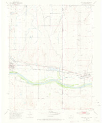
1953 Map of Holly East
USGS Topo · Published 1973About this map
The Colorado-Kansas state line bisects this 1953 survey, where the Arkansas River flows through the high plains. The landscape is defined by the legacy of Western transit, most notably the Old Santa Fe Trail which runs parallel to the Atchison Topeka and Santa Fe railroad tracks. This corridor connects the town of Holly in Prowers County to Coolidge across the state border.
Find a feature on this map
20 named features on this map. Tap any name to fly to it.
Don’t see what you’re looking for? This feature index may not catch every label — zoom into the map to look around manually.
Map Details
Editions of this 1953 Holly East Map
4 editions found
Other maps of this area

1890 · Granada
USGS Topo · 1:125,000

1891 · Albany
USGS Topo · 1:125,000

1892 · Granada
USGS Topo · 1:125,000

1893 · Albany
USGS Topo · 1:125,000

1894 · Granada
USGS Topo · 1:125,000

1900 · Syracuse
USGS Topo · 1:125,000

1920 · Syracuse
USGS Topo · 1:125,000

1953 · Holly West
USGS Topo · 1:24,000

1953 · Holly East
USGS Topo · 1:24,000

1954 · Lamar
USGS Topo · 1:250,000