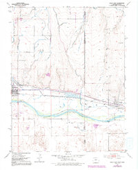
1953 Map of Holly East
USGS Topo · Published 1992About this map
The Arkansas River corridor along the Colorado-Kansas state line reveals a landscape deeply shaped by historic migration and water management. While the Old Santa Fe Trail cuts through the center of the sheet, its legacy is preserved at the Santa Fe Trail Marker and the nearby Site of Old Trail City south of the Holly Ditch. The towns of Holly and Coolidge serve as the primary hubs on either side of the border, connected by a network of essential irrigation features like the Buffalo Canal and the Amity Canal (Aband). Local life and aviation are reflected in the Holly Landing Strip and multiple burial grounds including the Holly Cemetery and Coolidge Cem. The map illustrates the agricultural transition from the river bottom to the high plains, where numerous wells and gaging stations monitor the vital flow through the valley.
Find a feature on this map
28 named features on this map. Tap any name to fly to it.
Don’t see what you’re looking for? This feature index may not catch every label — zoom into the map to look around manually.
Map Details
Editions of this 1953 Holly East Map
4 editions found
Other maps of this area

1890 · Granada
USGS Topo · 1:125,000

1891 · Albany
USGS Topo · 1:125,000

1892 · Granada
USGS Topo · 1:125,000

1893 · Albany
USGS Topo · 1:125,000

1894 · Granada
USGS Topo · 1:125,000

1900 · Syracuse
USGS Topo · 1:125,000

1920 · Syracuse
USGS Topo · 1:125,000

1953 · Holly West
USGS Topo · 1:24,000

1953 · Holly East
USGS Topo · 1:24,000

1954 · Lamar
USGS Topo · 1:250,000