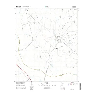
2014 Map of Holly Hill
USGS Topo · Published 2014About this map
Holly Hill serves as the central hub of this South Carolina landscape, where the historic Old State Rd intersects with a network of rural routes connecting scattered communities. The settlement pattern is defined by the convergence of agricultural land and expansive wetlands, most notably the wide reach of Four Hole Swamp to the west and south. Local heritage is deeply rooted in the numerous burial grounds and congregations documented here, such as the Corinth Baptist Church Cem and Bethlehem Southern Methodist Church Cem.
Find a feature on this map
90 named features on this map. Tap any name to fly to it.
Don’t see what you’re looking for? This feature index may not catch every label — zoom into the map to look around manually.
Map Details
Editions of this 2014 Holly Hill Map
This is the sole edition of this map. No revisions or reprints were ever made.
Other maps of this area

1919 · Ridgeville
USGS Topo · 1:48,000

1920 · Eutawville
USGS Topo · 1:48,000

1920 · Bowman
USGS Topo · 1:48,000

1920 · Ridgeville
USGS Topo · 1:62,500

1920 · St. George
USGS Topo · 1:48,000

1921 · Bowman
USGS Topo · 1:62,500

1921 · St. George
USGS Topo · 1:62,500

1921 · Eutawville
USGS Topo · 1:62,500

1943 · Bowman
USGS Topo · 1:62,500

1943 · Orangeburg
USGS Topo · 1:125,000