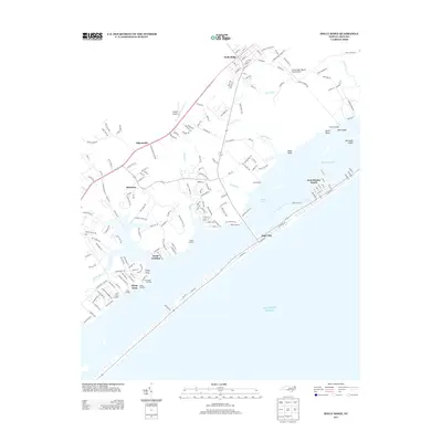
2013 Map of Holly Ridge
USGS Topo · Published 2013About this map
Holly Ridge serves as the inland anchor of this coastal landscape, situated near the Holly Ridge/Topsail Island Airport and Topsail Airpark. The area's relationship with the water is defined by a dense network of creek systems including Beckys Cr and Batts Mill Cr, which feed into Waters Bay. Along the mainland shore, a series of family and local landings such as Watts Landing, Edens Landing, and Sears Landing mark the historical points of access to the Banks Channel. This 2013 survey shows the developed coastal stretches of Surf City and West Onslow Beach, where the street grid tightly follows the barrier island's narrow profile against the Atlantic Ocean. Inland, smaller settlements like Edgecombe and Barlowes are connected by a web of rural roads, illustrating the transition from the maritime economy of Sloop Point to the aviation and transit hubs further north.
Find a feature on this map
183 named features on this map. Tap any name to fly to it.
Don’t see what you’re looking for? This feature index may not catch every label — zoom into the map to look around manually.
Map Details
Editions of this 2013 Holly Ridge Map
This is the sole edition of this map. No revisions or reprints were ever made.
Other maps of this area

1942 · Spicer Bay
USGS Topo · 1:62,500

1942 · Topsail
USGS Topo · 1:62,500

1948 · Maple Hill
USGS Topo · 1:62,500

1948 · Topsail
USGS Topo · 1:62,500

1948 · New River
USGS Topo · 1:62,500

1952 · Spicer Bay
USGS Topo · 1:24,000

1952 · Sneads Ferry
USGS Topo · 1:24,000

1953 · Beaufort
USGS Topo · 1:250,000

1954 · Beaufort
USGS Topo · 1:250,000

1970 · Hampstead
USGS Topo · 1:24,000