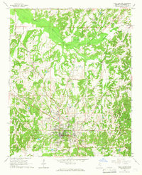
1965 Map of Holly Springs
USGS Topo · Published 1966About this map
Holly Springs serves as the focal point of this mid-1960s study, displaying a notable concentration of educational and religious institutions. The presence of both Rust College and the Mississippi Industrial College highlights the town's importance as a center for higher education in northern Mississippi during this era. The landscape is characterized by a dense network of family-named cemeteries and rural churches, such as Strawberry Plains Ch and New Harmony Ch, which suggest long-standing community ties in the surrounding countryside.
Find a feature on this map
43 named features on this map. Tap any name to fly to it.
Don’t see what you’re looking for? This feature index may not catch every label — zoom into the map to look around manually.
Map Details
Editions of this 1965 Holly Springs Map
2 editions found
Other maps of this area

1944 · Tyro
USGS Topo · 1:62,500

1944 · Potts Camp
USGS Topo · 1:62,500

1945 · Potts Camp
USGS Topo · 1:62,500

1948 · Byhalia
USGS Topo · 1:62,500

1953 · Holly Springs
USGS Topo · 1:62,500

1956 · Tupelo
USGS Topo · 1:250,000

1958 · Tupelo
USGS Topo · 1:250,000

1964 · Waterford
USGS Topo · 1:24,000

1964 · Holly Springs SE
USGS Topo · 1:24,000
1965 · Slayden
USGS Topo · 1:24,000