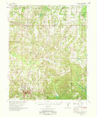
1969 Map of Holly Springs
USGS Topo · Published 1969About this map
Holly Springs serves as the focal point for this late 1960s survey, situated where the St Louis San Francisco and Illinois Central railroads intersect. The landscape is characterized by a dense network of rural landmarks, including numerous small churches and family cemeteries that reflect the social geography of Marshall and Benton counties. From Michigan City at the Tennessee border down through the Holly Springs National Forest, the map documents the transition between agricultural lands and protected woodlands. Notable local institutions like the Sand Flats Jr High Sch and the Strawberry Plains Ch anchor smaller communities such as Lamar and Hudsonville. Waterways like the Coldwater River and Wolf River frame the topography, while features such as Sand Flats and various lookouts point to the specific environmental and forestry management of the era.
Find a feature on this map
82 named features on this map. Tap any name to fly to it.
Don’t see what you’re looking for? This feature index may not catch every label — zoom into the map to look around manually.
Map Details
Editions of this 1969 Holly Springs Map
This is the sole edition of this map. No revisions or reprints were ever made.
Other maps of this area

1943 · Collierville
USGS Topo · 1:62,500

1944 · Tyro
USGS Topo · 1:62,500

1944 · Potts Camp
USGS Topo · 1:62,500

1945 · Potts Camp
USGS Topo · 1:62,500

1948 · Byhalia
USGS Topo · 1:62,500

1949 · Moscow
USGS Topo · 1:62,500

1950 · Ashland
USGS Topo · 1:62,500

1950 · Grand Junction
USGS Topo · 1:24,000

1951 · Grand Junction
USGS Topo · 1:24,000

1953 · Holly Springs
USGS Topo · 1:62,500