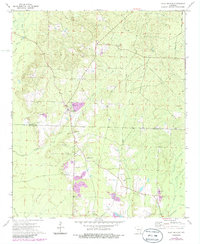
1973 Map of Holly Springs
USGS Topo · Published 1986About this map
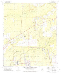
Holly Springs sits at the center of this rural Arkansas landscape, spanning the border of Dallas and Ouachita counties. The area is defined by a series of creeks flowing through the timbered terrain, including Tulip Creek, White Oak Creek, and Freeo Creek. Local community life is anchored by traditional landmarks like Holly Grove Church, White Spring Church, and several burial grounds such as Oak Grove Cemetery and Benton Cemetery. A prominent Holly Springs Lookout Tower overlooks the vicinity, while numerous Gravel Pits indicate the local extractive industry of the early 1970s. The settlement pattern follows the drainage of these waterways, with smaller named locales like Holly and Seale Springs linked by a network of country roads including Townsend Road.
Find a feature on this map
22 named features on this map. Tap any name to fly to it.
Don’t see what you’re looking for? This feature index may not catch every label — zoom into the map to look around manually.
Map Details
Editions of this 1973 Holly Springs Map
2 editions found
Other maps of this area

1903 · Camden
USGS Topo · 1:125,000

1953 · El Dorado
USGS Topo · 1:250,000

1957 · El Dorado
USGS Topo · 1:250,000

1958 · El Dorado
USGS Topo · 1:250,000

1960 · El Dorado
USGS Topo · 1:250,000
1971 · Sparkman
USGS Topo · 1:24,000

1971 · Ouachita
USGS Topo · 1:24,000
1971 · Harmony Grove
USGS Topo · 1:24,000

1973 · Bearden
USGS Topo · 1:24,000
1973 · Eagle Mills
USGS Topo · 1:24,000