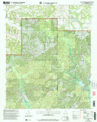
2000 Map of Holly Springs SE
USGS Topo · Published 2003About this map
The Holly Springs National Forest dominates this landscape along the border of Marshall and Benton Counties, where the headwaters of the Coldwater River and Big Snow Creek carve through the terrain. The map documents a rural community defined by its numerous hilltop churches and burial grounds, many of which carry family or locality names such as Mitchell Cem, Harris Chapel Cem, and Royston Chapel Cem. At the western edge, Hudsonville serves as a primary reference point for the surrounding network of country roads.
Find a feature on this map
41 named features on this map. Tap any name to fly to it.
Don’t see what you’re looking for? This feature index may not catch every label — zoom into the map to look around manually.
Map Details
Editions of this 2000 Holly Springs SE Map
This is the sole edition of this map. No revisions or reprints were ever made.
Other maps of this area

1944 · Potts Camp
USGS Topo · 1:62,500

1945 · Potts Camp
USGS Topo · 1:62,500

1950 · Ashland
USGS Topo · 1:62,500

1953 · Holly Springs
USGS Topo · 1:62,500

1955 · Blue Mountain
USGS Topo · 1:62,500

1956 · Tupelo
USGS Topo · 1:250,000

1958 · Tupelo
USGS Topo · 1:250,000

1964 · Waterford
USGS Topo · 1:24,000

1964 · Holly Springs SE
USGS Topo · 1:24,000
1965 · Slayden
USGS Topo · 1:24,000