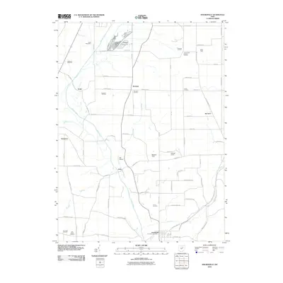
2010 Map of Holmesville
USGS Topo · Published 2010About this map
Killbuck Creek snakes through this portion of Wayne County, defining a valley that has shaped local settlement from the crossroads of Moreland to the village of Holmesville. The landscape is a mix of agricultural heritage and distinct geological markers, where elevations like Munson Knob and Sterrett Knob rise above the drainage basins of Savage Run and Tea Run. For those tracing family histories, the map is particularly rich in burial sites, documenting small community and family grounds such as Hermans Cemetery, Franks Cemetery, and the Trinity English Lutheran Cemetery. North of Holmesville, the Prairie Cemetery and West Prairie Cemetery sit near the southern edge of the quadrangle, while the presence of the Mill Brook Stock Farm and Moreland Fruit Farm underscores the area's long-standing connection to livestock and orchard production. This 2010 edition provides a clear view of the rural road network, linking smaller locales like Hard and McCance across the undulating Ohio terrain.
Find a feature on this map
71 named features on this map. Tap any name to fly to it.
Don’t see what you’re looking for? This feature index may not catch every label — zoom into the map to look around manually.
Map Details
Editions of this 2010 Holmesville Map
This is the sole edition of this map. No revisions or reprints were ever made.
Other maps of this area

1901 · Wooster
USGS Topo · 1:62,500

1903 · Wooster
USGS Topo · 1:62,500

1906 · West Salem
USGS Topo · 1:62,500

1908 · West Salem
USGS Topo · 1:62,500

1912 · Loudonville
USGS Topo · 1:62,500

1914 · Loudonville
USGS Topo · 1:62,500

1915 · Millersburg
USGS Topo · 1:62,500

1943 · Millersburg
USGS Topo · 1:62,500

1943 · Loudonville
USGS Topo · 1:62,500

1950 · Marion
USGS Topo · 1:250,000