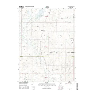
2016 Map of Holmesville
USGS Topo · Published 2016About this map
Killbuck Creek and the expansive Killbuck Swamp dominate the western lowlands of this Wayne and Holmes County borderland. The terrain is defined by distinct elevations such as Munson Knob and Sterrett Knob, which overlook the agricultural valleys and the larger settlement of Holmesville along the southern edge. The landscape is dotted with several small, historic burial grounds that speak to the area's early settlement patterns, including Moreland Cem, Hermans Cem, and the uniquely named Trinity English Lutheran Cem.
Find a feature on this map
131 named features on this map. Tap any name to fly to it.
Don’t see what you’re looking for? This feature index may not catch every label — zoom into the map to look around manually.
Map Details
Editions of this 2016 Holmesville Map
This is the sole edition of this map. No revisions or reprints were ever made.
Other maps of this area

1901 · Wooster
USGS Topo · 1:62,500

1903 · Wooster
USGS Topo · 1:62,500

1906 · West Salem
USGS Topo · 1:62,500

1908 · West Salem
USGS Topo · 1:62,500

1912 · Loudonville
USGS Topo · 1:62,500

1914 · Loudonville
USGS Topo · 1:62,500

1915 · Millersburg
USGS Topo · 1:62,500

1943 · Millersburg
USGS Topo · 1:62,500

1943 · Loudonville
USGS Topo · 1:62,500

1950 · Marion
USGS Topo · 1:250,000