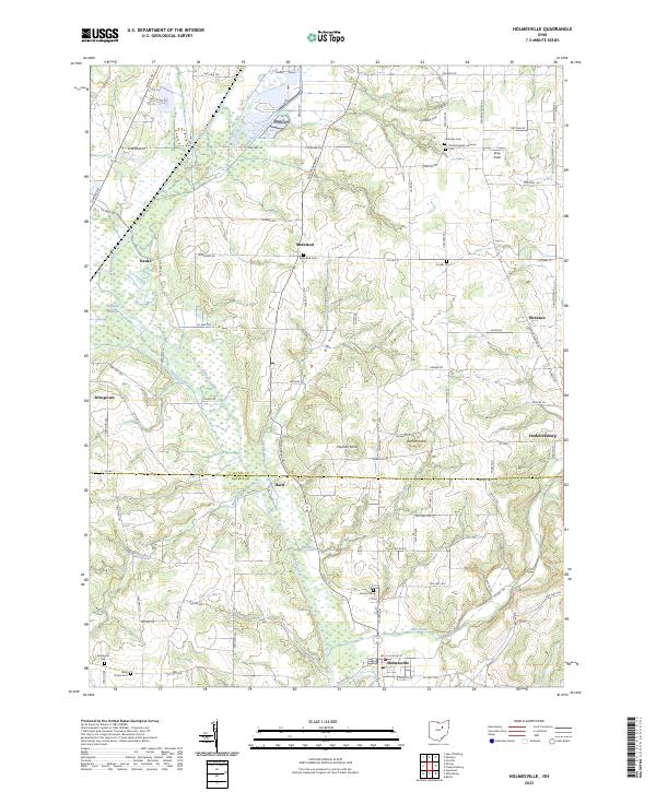
2023 Map of Holmesville
USGS Topo · Published 2023About this map
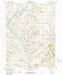
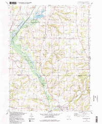
Holmesville and the surrounding agricultural lands of Holmes and Wayne Counties are defined by the winding course of Killbuck Creek and the adjacent Killbuck Swamp. This 2023 survey illustrates a landscape deeply rooted in tradition, where small settlements like Moreland and Fredericksburg anchor a network of rural township roads. The map is a vital resource for genealogical research, documenting numerous burial sites such as the Trinity English Lutheran Cem, Franks Cem, and the West Prairie Cem.
Find a feature on this map
102 named features on this map. Tap any name to fly to it.
Don’t see what you’re looking for? This feature index may not catch every label — zoom into the map to look around manually.
Map Details
Editions of this 2023 Holmesville Map
This is the sole edition of this map. No revisions or reprints were ever made.
Historical Maps of Kauke Through Time
3 maps found