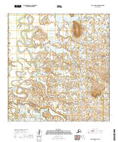
2019 Map of Holy Cross A-1 SW
USGS Topo · Published 2019About this map
Paimiut Slough winds through this expanse of the Yukon Delta, defining a landscape dominated by complex waterways and low-lying wetlands. This 2019 survey documents the intricate hydrologic patterns of the Alaskan interior, where small unnamed ponds and saturated marshes fill the spaces between larger water bodies like Reindeer Lake. The area is geographically significant as it marks the boundary between the Yukon-Koyukuk Census Area and the Bethel Census Area. Unlike more developed regions, the landscape here is shaped by natural drainage and seasonal shifts, with the slough system acting as a vital corridor through the flat terrain. The map provides a precise look at the township and range divisions, such as T24N R55W and T23N R56W, which organize this vast wilderness for land management and resource tracking.
Find a feature on this map
12 named features on this map. Tap any name to fly to it.
Don’t see what you’re looking for? This feature index may not catch every label — zoom into the map to look around manually.
Map Details
Editions of this 2019 Holy Cross A-1 SW Map
This is the sole edition of this map. No revisions or reprints were ever made.
Other maps of this area

1947 · Russian Mission
USGS Topo · 1:250,000

1950 · Russian Mission
USGS Topo · 1:250,000

1951 · Holy Cross
USGS Topo · 1:250,000

1952 · Holy Cross A-2
USGS Topo · 1:63,360

1952 · Holy Cross A-1
USGS Topo · 1:63,360

1952 · Russian Mission D-2
USGS Topo · 1:63,360

1952 · Holy Cross
USGS Topo · 1:250,000

1952 · Russian Mission D-1
USGS Topo · 1:63,360

1980 · Russian Mission
USGS Topo · 1:250,000
2019 · Russian Mission D-2 NE
USGS Topo · 1:25,000