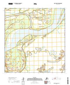
2019 Map of Holy Cross A-2 SW
USGS Topo · Published 2019About this map
The Yukon River dominates this interior landscape, carving a wide path through the riverine environment of the Yukon-Koyukuk Census Area. This 2019 survey documents a complex network of side channels and wetlands, where the main river current is supplemented by the Big Bend Slough and Cottonwood Slough. These waterways define the shifting boundaries of landforms like Horse Island, illustrating the dynamic nature of Alaskan river systems.
Find a feature on this map
13 named features on this map. Tap any name to fly to it.
Don’t see what you’re looking for? This feature index may not catch every label — zoom into the map to look around manually.
Map Details
Editions of this 2019 Holy Cross A-2 SW Map
This is the sole edition of this map. No revisions or reprints were ever made.
Other maps of this area

1947 · Russian Mission
USGS Topo · 1:250,000

1950 · Russian Mission
USGS Topo · 1:250,000

1951 · Holy Cross
USGS Topo · 1:250,000

1952 · Holy Cross A-2
USGS Topo · 1:63,360

1952 · Holy Cross A-3
USGS Topo · 1:63,360

1952 · Russian Mission D-2
USGS Topo · 1:63,360

1952 · Holy Cross
USGS Topo · 1:250,000

1952 · Russian Mission D-3
USGS Topo · 1:63,360

1980 · Russian Mission
USGS Topo · 1:250,000
2017 · Holy Cross A-3 NE
USGS Topo · 1:25,000