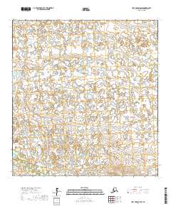
2017 Map of Holy Cross B-6 SW
USGS Topo · Published 2017About this map
The Nageethluk River winds through the southwestern corner of this landscape in the Kusilvak Census Area, providing a primary hydrological anchor for the surrounding wilderness. This 2017 survey reveals an intricate network of small lakes and wetlands characteristic of the Yukon Delta region. The terrain is structured by the Public Land Survey System, with township boundaries such as T26n R68w and T26n R67w defining the grid. The absence of roads or permanent settlements in this quadrangle highlights the preservation of traditional subsistence land use patterns. This detailed mapping by the U.S. Geological Survey captures the subtle elevation changes and water distribution in a territory where seasonal shifts dictate the movement of both wildlife and people.
Find a feature on this map
7 named features on this map. Tap any name to fly to it.
Don’t see what you’re looking for? This feature index may not catch every label — zoom into the map to look around manually.
Map Details
Editions of this 2017 Holy Cross B-6 SW Map
This is the sole edition of this map. No revisions or reprints were ever made.
Other maps of this area

1951 · Holy Cross
USGS Topo · 1:250,000

1952 · Kwiguk
USGS Topo · 1:250,000

1952 · Holy Cross B-6
USGS Topo · 1:63,360

1952 · Kwiguk A-1
USGS Topo · 1:63,360

1952 · Kwiguk B-1
USGS Topo · 1:63,360

1952 · Holy Cross A-6
USGS Topo · 1:63,360

1952 · Holy Cross
USGS Topo · 1:250,000
2017 · Holy Cross A-6 NW
USGS Topo · 1:25,000
2017 · Holy Cross B-6 SE
USGS Topo · 1:25,000
2017 · Holy Cross A-6 NE
USGS Topo · 1:25,000