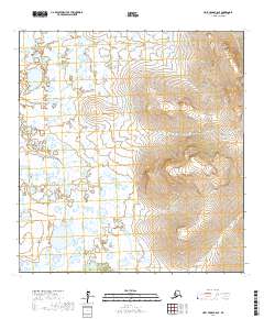
2017 Map of Holy Cross B-6 SE
USGS Topo · Published 2017About this map
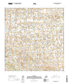
Allman Lake sits at the heart of this Kusilvak landscape, a region defined by its expansive hydrological network and undulating elevation. The terrain transition is marked by the Nageethluk River, which winds through the southwestern quadrant, illustrating the complex drainage patterns common to this part of the Alaska interior. The eastern portion of the survey is characterized by significant topographic relief, with contour lines indicating a prominent upland area that stands in sharp contrast to the marshy lowlands surrounding the lake. This 2017 study provides a precise look at the township boundaries of t26n r66w and t25n r67w, offering essential data for understanding the intersection of land management and natural water systems in this part of the Holy Cross B-6 SE quadrangle.
Find a feature on this map
6 named features on this map. Tap any name to fly to it.
Don’t see what you’re looking for? This feature index may not catch every label — zoom into the map to look around manually.
Map Details
Editions of this 2017 Holy Cross B-6 SE Map
This is the sole edition of this map. No revisions or reprints were ever made.
Other maps of this area

1951 · Holy Cross
USGS Topo · 1:250,000

1951 · Holy Cross A-5
USGS Topo · 1:63,360

1952 · Holy Cross B-6
USGS Topo · 1:63,360

1952 · Holy Cross B-5
USGS Topo · 1:63,360

1952 · Holy Cross A-6
USGS Topo · 1:63,360

1952 · Holy Cross
USGS Topo · 1:250,000
1952 · Holy Cross A-5
USGS Topo · 1:63,360
2017 · Holy Cross B-5 SW
USGS Topo · 1:25,000
2017 · Holy Cross B-5 NW
USGS Topo · 1:25,000
2017 · Holy Cross B-6 SW
USGS Topo · 1:25,000