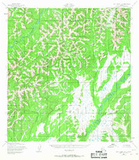
1952 Map of Holy Cross C-6
USGS Topo · Published 1967About this map
The East Fork Andreafsky River and the Atchuelinguk River dominate this interior landscape, illustrating the complex drainage patterns of the Alaskan bush during the early 1950s. The map reveals an area defined by winding river systems and unnamed peaks, captured by the Army Map Service using photogrammetric methods from aerial photography. While no permanent settlements are recorded on this sheet, the intricate network of tributaries and land forms suggests the seasonal transit routes and traditional hunting grounds characteristic of the region before modern development. The survey provides a clear view of the topographical relief and watercourses as they existed when land lines were still being predetermined by the Bureau of Land Management.
Find a feature on this map
2 named features on this map. Tap any name to fly to it.
Don’t see what you’re looking for? This feature index may not catch every label — zoom into the map to look around manually.
Map Details
Editions of this 1952 Holy Cross C-6 Map
2 editions found
Other maps of this area

1951 · Holy Cross
USGS Topo · 1:250,000

1952 · Kwiguk
USGS Topo · 1:250,000

1952 · Kwiguk D-1
USGS Topo · 1:63,360

1952 · Holy Cross C-6
USGS Topo · 1:63,360

1952 · Holy Cross C-5
USGS Topo · 1:63,360

1952 · Holy Cross D-5
USGS Topo · 1:63,360

1952 · Holy Cross B-6
USGS Topo · 1:63,360

1952 · Holy Cross B-5
USGS Topo · 1:63,360

1952 · Kwiguk B-1
USGS Topo · 1:63,360

1952 · Kwiguk C-1
USGS Topo · 1:63,360