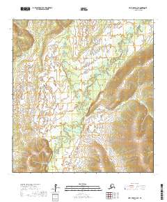
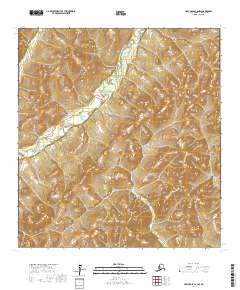
2017 Map of Holy Cross C-6 SE
USGS Topo · Published 2017About this map
The Atchuelinguk River winds through this expanse of the Kusilvak Census Area, illustrating the complex hydrography of the Alaskan interior as it appeared in the early 21st century. This 2017 study shows a landscape dominated by riparian wetlands and significant elevation changes, with the river serving as the primary geographical anchor for the surrounding wilderness. The survey documents the Public Land Survey System grids, including T29n R65w, T29n R66w, and T28n R66w, which provide essential reference points for land claims and historical research in a region largely devoid of permanent settlements or road infrastructure. The map's contour lines and wetland markers offer a precise record of the drainage patterns and terrain shifts that define the watershed of the lower Yukon River area.
Find a feature on this map
5 named features on this map. Tap any name to fly to it.
Don’t see what you’re looking for? This feature index may not catch every label — zoom into the map to look around manually.
Map Details
Editions of this 2017 Holy Cross C-6 SE Map
This is the sole edition of this map. No revisions or reprints were ever made.
Other maps of this area

1951 · Holy Cross
USGS Topo · 1:250,000

1952 · Holy Cross C-6
USGS Topo · 1:63,360

1952 · Holy Cross C-5
USGS Topo · 1:63,360

1952 · Holy Cross B-6
USGS Topo · 1:63,360

1952 · Holy Cross B-5
USGS Topo · 1:63,360

1952 · Holy Cross
USGS Topo · 1:250,000
2017 · Holy Cross C-5 SW
USGS Topo · 1:25,000
2017 · Holy Cross C-5 NW
USGS Topo · 1:25,000
2017 · Holy Cross B-5 NW
USGS Topo · 1:25,000
2017 · Holy Cross C-6 NW
USGS Topo · 1:25,000